






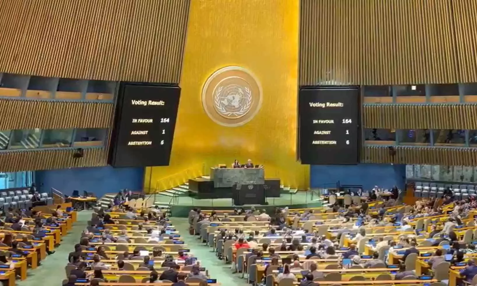
The United Nations General Assembly has passed a resolution calling for wider use of maps that represent the actual size of continents more accurately. Photo: X/@_AfricanUnion
UNGA: India, 163 countries vote for new world map with bigger Africa; US votes against
Resolution “Correct the Map” seeks to promote a “more accurate representation” of continents and address “historical biases” in cartographic representation

Soon, the world map could look very different. Africa and Latin America will appear larger, while Europe and North America could look substantially smaller.
In a major move, the United Nations General Assembly (UNGA) has passed a resolution calling for wider use of maps that represent the actual size of continents more accurately. The resolution, led by Togo and backed by the African Union, received 164 votes in favour. Six countries abstained, including Estonia, Georgia, Lithuania, Moldova, Serbia and Ukraine, while the United States was the only country to vote against it.
The resolution
The resolution, titled “Correct the Map”, seeks to promote a “more accurate representation” of continental landmasses and address what it describes as historical biases in cartographic representation, particularly towards Africa.
It encourages governments and institutions to consider the Equal Earth projection when comparing the size of countries and continents.
Also read: From 'also-rans' to powerhouses: How Africa scripted historic World Cup in 2026
The Equal Earth projection was developed by cartographers in 2018. Unlike the Mercator projection, it is an equal-area map, meaning countries and continents are shown in proportion to their actual surface areas while retaining recognisable shapes.
Is Mercator map wrong?
The Mercator projection was developed by Flemish cartographer Gerardus Mercator in 1569. It was primarily designed for maritime navigation, preserving directions and angles so sailors could plot courses accurately.
But, the projection increasingly enlarges land masses as they move away from the equator towards the poles. This makes northern regions appear much larger than they actually are, while areas closer to the equator, including much of Africa, appear relatively smaller.
For example the projection of Greenland and Africa. In reality, Africa is about 14 times larger than Greenland. But on a Mercator map, Greenland appear comparable in size, or even larger depending on the map.
Europe, North America and Russia too get greater visual prominence relative to Africa, South America and parts of Asia.
However, the Mercator map is not geographically “wrong”. Its distortion comes from the purpose for which it was originally created.
How is Equal Earth different?
Equal Earth is an equal-area projection, meaning it preserves the relative size of landmasses.
Africa therefore appears considerably larger than it does on a Mercator map, while Europe and North America appear smaller. Latin America, South Asia and Oceania also gain visual size in relative terms.
Also read: Lake Ontario is now Lake America on Apple, Google maps; can Trump change names?
This projection was created in 2018 by a group of cartographers as an alternative that could show the world's landmasses more accurately without the extreme size distortion associated with Mercator.
The resolution supporters
The resolution argues that distortions in the size of continents, inherited through centuries of mapmaking, have cognitive, educational, cultural, geopolitical and socioeconomic effects. The African Union welcomed the vote as a “historic step” towards more accurate and equitable global cartographic representation.
India also supported the broader idea behind the resolution, but clarified that it was not endorsing one particular map.
India’s stand
Explaining India's position in the General Assembly, First Secretary at India's Permanent Mission to the UN, Raghoo Puri, said India “welcomes” the intention behind the resolution to promote more accurate and representative cartographic practices. “We believe that maps play an important role in how societies understand geography and the relative scale of the world around us,” he said.
However, India made it clear that the resolution should not be interpreted as an endorsement of the Equal Earth projection specifically. “We believe that the resolution should be understood as supporting the broader use and consideration of Equal Area map projections, and not as endorsing the Equal Earth projection or any other specific map projection,” Puri said.
He added that equal-area projections are particularly relevant because they preserve the relative sizes of continental and territorial landmasses.
Also read: US drops ‘Indo’ from Pacific Command name, raises questions on regional strategy
Pakistan also voted in favour, saying it supported the initiative only in terms of accurately representing continental landmasses and not countries' political maps or boundaries.
US’s opposition
The United States, meanwhile, strongly opposed the resolution.
Washington argued that the UN should be focusing on genuine global challenges rather than debating a map created in the 16th century. US representative Yaryna Ferencevych said such debates were “the reason this institution is losing its credibility”.
She also accused the resolution of promoting an “ideological agenda” involving reparations and “cognitive justice”.
Will maps actually change?
The UN vote does not mean that every map, school textbook or digital platform will suddenly switch from Mercator to Equal Earth.
Its impact will depend on whether schools, publishers, international institutions and mapping platforms decide to adopt equal-area projections, particularly when the relative size of countries and continents is important.
(With agency inputs)