





Nepal disaster puts North Bengal’s vulnerability to Himalayan floods in focus
Glacial lakes, hanging glaciers and landslides upstream are raising concerns over flash floods in North Bengal, prompting calls for better monitoring and early-warning systems

For Phulmaya Viswakarma, a woman in her 40s from Tollo Gaon in the Rangpo Forest area of West Bengal’s Kalimpong district, the night of October 4, 2023, remains an unhealed memory.
Her small grocery and cosmetics shop, along with her home, was swept away when the Teesta surged downstream after the South Lhonak Lake outburst in Sikkim. Viswakarma and her family of four survived, but lost both their home and livelihood. “We spent our days crying, mourning and in a state of shock, unable to think clearly,” she recalled.
Nearly three years on, Viswakarma has rented a small accommodation in nearby Matlo Gaon and opened another grocery shop, slowly rebuilding a life washed away by the flood.
Also read | From NCC to ‘surgical strike’, how BJP is trying to reshape West Bengal’s campuses
“Sometimes I go for a walk around my former house, sit there and grieve. Then I motivate myself by engaging in some work,” she said. “But the spectre of another flash flood continues to haunt us.”
Hanging glaciers raise alarm
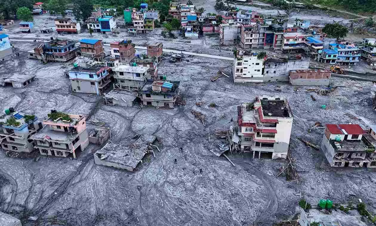
That fear has been reinforced by the devastating flash flood in Nepal, which has drawn fresh attention to the complex mountain hazards that can send sudden surges of water and debris downstream into the Himalayan foothills and plains.
For North Bengal, the concern is particularly relevant because the Teesta basin receives water from upstream Sikkim, where the landscape is dotted with glacial lakes, including those classified as high or very high risk. Besides, the presence of glaciers and hanging ice masses also raises the possibility of sudden floods carrying large volumes of debris downstream.
A multidisciplinary team of the Sikkim government recently found that Chumilamcha lake, at an altitude of 4,800 metres, contains about five million cubic metres of water beneath a 1-km-long hanging glacier, official sources said. The Sikkim Science and Technology Department has classified it as a Category-A high-risk lake, sources added.
The Nepal disaster has brought hanging glaciers into sharper focus, said Tsering Tashi, a retired geologist with the Sikkim government’s mines and geology department. He said hanging ice masses perched on steep slopes can collapse and trigger avalanches and debris flows downstream, but are “often overlooked in hazard assessments.”
Qianggong Zhang, head of climate and environmental risks at the International Centre for Integrated Mountain Development (ICIMOD), told the media that an ice avalanche in the Lhende Khola, a mountain river near the Nepal-Tibet border, was the suspected trigger in Nepal, although the sequence was still being investigated. ICIMOD is an intergovernmental organisation representing eight Hindu Kush Himalayan countries.
Sikkim’s glacial risks persist
For North Bengal, the risk was demonstrated in 2023 when South Lhonak Lake in North Sikkim burst after a large mass of rock and ice fell into the lake, sending a destructive surge down the Teesta.
The National Disaster Management Authority described the ensuing flood as a 20-metre-high displacement wave. The flood destroyed hydropower assets and settlements in Sikkim before surging down the Teesta into West Bengal, causing widespread damage in Darjeeling and Kalimpong districts.
The Centre’s Glacial Lake Atlas mapped 4,707 glacial lakes in the Ganga basin, covering nearly 2.5 lakh sq km from the river’s origin to the Himalayan foothills. The National GLOF (Glacial Lake Outburst Flood) Risk Mitigation Programme has identified 195 high-risk glacial lakes across the Himalayan states.
Sikkim has about 320 glacial lakes, of which 14 are classified as high-risk, according to the latest state government assessment released in July this year. Research shows that Sikkim’s glaciers and glacial lakes are changing and expanding. A study published in Geomatics, Natural Hazards and Risk, which used satellite imagery and machine learning to track Sikkim’s glacial lakes, found 492 lakes, of which 406 measured at least 0.01 sq km at some point.
Of the 144 lakes that appeared consistently in all 11 satellite observations, 32 showed steady expansion. The study warned that continued expansion could increase the risk of GLOF.
Multiple hazards threaten Teesta
Dipayan Dey, climate critic, restoration ecologist and founder-trustee of the South Asian Forum for Environment, said the risk assessment should not be confined to glacial lakes in Sikkim, as other high-altitude water bodies and permafrost thaw could also affect downstream areas.
He said Bhutan, which has more than 1,000 permafrost lakes according to his assessment, also needs closer scrutiny because such lakes can expand as frozen ground thaws. “These lakes on permafrost are a potential threat not only to North Bengal, but also to Assam and Sikkim,” Dey told The Federal.
Also read | Durga Puja becomes new battleground for BJP factions in Bengal
The Teesta basin also faces a substantial landslide threat, as pointed out by a July study published in Discover Environment, a peer-reviewed scientific journal published by Springer Nature.
The study examined 8,341 sq km of the Teesta basin using data from 1,151 historical landslides and factors including terrain, rainfall, geology and land use. It classified 963.94 sq km as highly susceptible and 583.92 sq km as very highly susceptible, together accounting for 18.6 per cent of the study area.
A separate 2024 study divided the Teesta basin into 35 sub-basins and identified 17 as highly susceptible to landslides, using a database of 2,387 landslide locations. It found annual rainfall of around 2,000 to 5,000 mm and noted that intense spells of 300 to 400 mm over two to three days could trigger multiple shallow landslides.
Beyond Teesta, more rivers at risk
Dey said the extent of the damage would also depend on the scale of unplanned and unscientific development and urbanisation in vulnerable areas. “The Himalayas are still growing and remain geologically unstable, but there is no thumb rule or special rule to monitor and regulate urbanisation in vulnerable areas,” he said.
The threat to North Bengal, however, extends beyond the Teesta. The Balason, Mahananda, Torsa and Jaldhaka descend from steep Himalayan and foothill terrain before entering the plains, where sudden increases in discharge can become more destructive when accompanied by sediment, boulders, trees and debris.
A flash flood in the Mal river at Malbazar in October 2022 killed eight people. In October 2025, the Rangbhang, a tributary of the Balason, surged through Tabakoshi in Mirik, destroying more than 15 homestays and washing away the bridge over the Balason at Dudhia, leaving more than 100 tourists stranded.
These repeated flash floods have prompted the state government to focus on improving the carrying capacity of rivers in North Bengal. The irrigation department plans to dredge at least 16 major and medium-sized rivers across Darjeeling, Kalimpong, Jalpaiguri, Alipurduar and Cooch Behar after the monsoon.
“Dredging is not possible during the monsoon. But the work will be accelerated afterwards,” said Krishnendu Bhowmik, chief engineer of the irrigation department’s north-eastern zone.
Dey, however, cautioned against relying on dredging as the principal response to flash floods. “Dredging alone will not help much in the case of a flash flood. At best, it can minimise the initial impact,” he said.
Early warning systems hold key
Dredging may improve the carrying capacity of downstream rivers, but it cannot stop a glacier collapse or prevent a landslide from blocking an upstream river, he further explained. That makes early warning and risk assessment critical.
The Centre has allocated Rs 150 crore for the National GLOF Risk Mitigation Programme covering Sikkim, Arunachal Pradesh, Himachal Pradesh and Uttarakhand, with Sikkim receiving Rs 40 crore. The programme covers hazard assessment, monitoring, early-warning systems and mitigation.
Sikkim has also stepped up scientific monitoring of high-risk glacial lakes, conducting multidisciplinary assessments that include bathymetric, geological, geophysical, hydrological, geomorphological and meteorological studies.
According to state government sources, the Centre for Development of Advanced Computing under the Ministry of Electronics and Information Technology handed over an indigenous autonomous system to Sikkim in June for glacial-lake profiling and risk assessment. However, concerns remain over the effectiveness of existing warning systems, the sources added.
Also read | Bengal BJP faces heat as charges of cut money, factional feud echo TMC-era practices
Solar-powered automated weather stations and twin-camera systems were earlier installed at South Lhonak and Shako Cho, but they were found to have limited effectiveness.
The Centre is now preparing a programme to install automated weather stations and early-warning systems at all high-risk glacial lakes.
Dey said the availability of satellite imagery and other modern tools makes it possible to identify vulnerable areas and improve disaster mapping before an event occurs. “A disaster of this kind cannot be prevented. If it has to happen, it will happen. But the damage can be mitigated through proper planning and risk assessment,” he said.
For North Bengal, such upstream monitoring is critical because the 2023 GLOF showed how quickly a disaster originating in North Sikkim can affect communities and infrastructure downstream.