








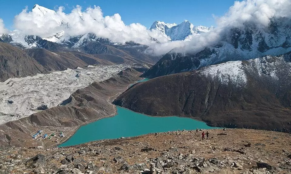
Among the most significant changes, Gepang Gath lake in Lahaul-Spiti district expanded around 244,000 square metres due to melting glacier. Representative image: Wikimedia commons
Nepal floods raise alarm in Himachal: IIT Mandi flags 9 glacial lakes
Study maps 2,076 glacial lakes situated above 3,500 metres in Himachal Pradesh in 2025, around 710 more than those recorded in 2015

Shimla, Sep 5 (PTI) The unprecedented devastation and loss of lives in the wake of the Nepal flash floods have set off the alarm bells for Himachal Pradesh, with researchers from the Indian Institute of Technology (IIT) Mandi identifying nine rapidly expanding glacial lakes in the state -- terming them ticking "water bombs".
These lakes could pose a serious threat to downstream communities as rising temperatures accelerate melting of glaciers across the Himalayas, IIT-Mandi researchers said.
The researchers, through analysis of satellite imagery and other datasets, found that the number of glacial lakes in the Himalayan region has increased by nearly 30 per cent over the past decade -- their size, too, has expanded significantly.
This raises concerns over the possibility of sudden glacial lake outburst floods that could unleash massive volumes of water and debris downstream, said Prof Dericks P Shukla, Founding Chairperson, School of Civil and Environmental Engineering, IIT-Mandi, who led the six-member research team.
The study identified nine lakes -- Kalikund, Chandratal, Vasuki, Surai, Kya Tso, Yoche, Samudra Tapu, Kasang and Gepang Gath -- located in high-altitude regions of Chamba and Lahaul-Spiti as particularly vulnerable, capable of acting like "water bombs" if their natural barriers fail.
A sudden drainage event triggered by a landslide, earthquake or other geological disturbances could cause widespread destruction in valleys below. More than 15 bridges, several inhabited areas and educational and healthcare institutions fall within the potential hazard zones of these lakes, the study warned.
The study mapped 2,076 glacial lakes situated above 3,500 metres in Himachal Pradesh in 2025 -- around 710 more than those recorded in 2015 -- and found that their cumulative area has increased by 28.45 per cent over the past decade, underscoring the growing risk of glacial lake outburst floods (GLOFs) in the state.
Among the most significant changes, Gepang Gath lake in Lahaul-Spiti district expanded around 244,000 square metres due to melting glacier. Kasang lake in Kinnaur grew by nearly 150,000 square metres, while Kalikund in Kangra and Chamba districts expanded by around 120,000 square metres.
Researchers flagged Kalikund as especially sensitive because of the steep slopes surrounding the lake, which could increase the risk of a sudden collapse or outburst.
The study also pointed out human activity as a possible factor accelerating glacier melt and cautioned that increasing tourist activity in the sensitive Himalayan regions can raise dust deposition on glaciers, which absorbs more sunlight than clear snow and ice.
Natural disasters such as earthquakes and landslides can further destabilise glacial lakes, triggering sudden flooding.
Government agencies, including the Central Water Commission (CWC) and the National Disaster Management Authority (NDMA), currently classify four glacial lakes in Himachal Pradesh as sensitive -- three of these also feature in the IIT-Mandi study.
Satellite technology has made it easier to track these rapidly changing lakes, but field-based monitoring, early warning systems and stronger government intervention are urgently needed, researchers stressed.
On the other hand, the Himachal Pradesh government has sought Rs 105 crore from the Centre to install early warning systems (EWS) and undertake other mitigation measures at four major glacial lakes, officials said on Saturday.
Additionally, the CWC will carry out flow-path analysis and downstream risk assessment for 681 glacial lakes in the Himalayan region, while an integrated risk-categorisation framework will be developed by the NDMA, officials said. PTI