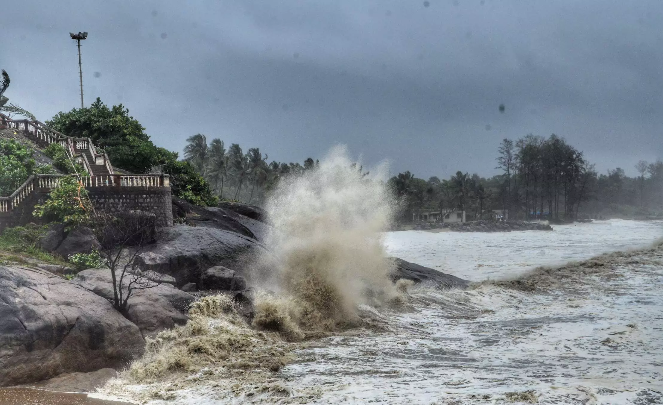
Cyclone Ditwah inches closer to Tamil Nadu; heavy rain likely
IMD issues red alert; govt deploys NDRF and SDRF teams

Cyclone Ditwah has been slowly heading towards the Tamil Nadu coast and is likely to cause heavy rainfall in the state, the India Meteorological Department (IMD) said. The Tamil Nadu government has also reviewed its preparedness in view of the approaching storm.
IMD warns of heavy rainfall
The IMD on Friday (November 29) predicted heavy rains in the southern and Cauvery delta districts of the state, between November 29 and 30.
The name, 'Ditwah', referring to a lagoon, was suggested by Yemen. It is likely named after Detwah Lagoon, a large, saline lagoon on the northwest coast of the island of Socotra in Yemen.
Also Read: Sri Lanka floods kill 56 as Cyclone Ditwah nears Trincomalee
The IMD in a bulletin stated that the cyclonic storm 'Ditwah' over Sri Lanka coast and adjoining southwest Bay of Bengal moved slowly northwards with a speed of 7 kmph during the past 6 hours and lay centred at the same region at 5.30 pm on Friday.
It is located about 270 km south-southeast of Karaikal, 380 km south-southeast of Puducherry and 490 km south-southeast of Chennai, the bulletin said.
Late last month, Cyclone Montha brought heavy rains in the northern districts of the state.
‘Red alert southern and delta districts’: Stalin
Meanwhile, the Chief Minister reviewed the situation in the state. Speaking to reporters at the state emergency operations centre, he said, "A red alert (extremely heavy rain of over 20 cm in 24 hours) has been issued for the southern and delta districts." "I held a video conference with the collectors of the districts where red alerts have been sounded. Already, a meeting of higher officials was convened with senior officials yesterday (Thursday) to issue detailed instructions," added Stalin.
The Chief Minister further stated said his government has deployed senior officials in vulnerable districts, and all of them have already reached their assigned areas.
Also Read: Cyclone Ditwah nearing Tamil Nadu coast as rare Senyar heads to Malaysia
"I have directed them to remain on high alert, especially in locations badly hit (in the past). They have been instructed to constantly monitor and take steps to prevent any disruption, including snapping of powerlines,” he added.
According to the IMD bulletin, the cyclone is "very likely to move north-northwestwards across the Sri Lanka coast and adjoining southwest Bay of Bengal and reach over the southwest Bay of Bengal near north Tamil Nadu, Puducherry and adjoining south Andhra Pradesh coasts by early morning of November 30."
16 SDRF, 12 NDRF teams deployed
The Chief Minister instructed the officials to work in 'tandem' while ordering them to keep a stock of essential items, including food and milk, and to take necessary actionto clear floodwater in residential areas. He noted that 16 state disaster response forces and 12 NDRF teams have been deployed in districts expecting heavy rainfall.
Also Read: Why Hurricane Melissa is a wake-up call on how a warming climate can intensify natural disasters
Stalin said that Chennai is expected to receive heavy rainfall. "They (Meteorological department) warned of heavy rain in Chennai as well." Detailing the measures taken by the government, he said, "Camps have been readied with food and essential supplies. Orders have also been issued for the immediate evacuation of people from low-lying areas."
“Ministers in charge have reached the districts and are continuously monitoring the situation,” he added.
Measures by health department
On the measures taken by the health department in view of the Cyclone, Minister for Health and Family Welfare Ma Subramanian said the health department has been instructed to ensure medical teams are available round the clock in all government hospitals, in view of the heavy rainfall forecast.
Also Read: Revanth Reddy to conduct aerial survey as Cyclone Montha batters Telangana
"Steps have also been taken to ensure uninterrupted power supply in all hospitals in view of the heavy rainfall", he told reporters.
In its warning to fishermen, the weather office said rough to very rough sea conditions are prevailing. "It is likely to become very rough to high sea conditions till November 30. From December 1, it is likely to improve gradually," it said.
IndiGo cancels flights
Meanwhile, in view of the adverse weather conditions, IndiGo has cancelled several flights operating to and from Jaffna, Puducherry, Tuticorin, and Tiruchirappalli on November 29 (Saturday).
In a social media post on Friday, IndiGo appealed to passengers to check flight status before leaving for the airport. Flight services operated by IndiGo on various routes in the domestic sector have been impacted due to the cyclone, reported PTI, quoting airport sources.
Also Read: Cyclone Montha causes Rs 5,265 crore loss in Andhra Pradesh: CM Naidu
In a social media post on Friday evening, IndiGo said, "Due to the prevailing cyclonic conditions and heavy rainfall associated with Cyclone Ditwah, flights to and from Jaffna, Puducherry, Tuticorin and Trichy may experience disruptions." If their flight is impacted, passengers can easily explore alternative travel options or claim a refund, the airline said.
Rameswaram-Okha Express cancelled
The Southern Railway said in view of the wind velocity on Pamban Bridge recording 58 kmph, it cancelled the Rameswaram-Okha Express to be operated on Friday night.
The origin of as many as 11 trains operated in the Rameswaram-Chennai sector has been changed to Mandapam, Ramanathapuram, Ucchippuli due to cyclone over the next two days, Southern Railway said.
(With agency inputs)

