Cyclone Ditwah effect: Heavy rain forecast for TN; schools shut in many districts
Tamil Nadu gets heavy rain as Cyclone Ditwah’s remnant stalls near coast, flooding Chennai and nearby districts; Met warns of more heavy rain and rough seas

As coastal Tamil Nadu and several interior parts of the state experienced widespread rain on Wednesday (December 3), the Regional Meteorological Centre (RMC) in Chennai warned of heavy to very heavy rain in isolated pockets over the Nilgiris, Erode, and Coimbatore districts.
It also forecast heavy rain in Theni, Dindigul, Tiruppur, Tenkasi, Tirunelveli, Kanyakumari, Salem, and Namakkal districts.
Following the forecast, several district administrations across the state announced a holiday for educational institutions on December 3.
North Chennai flooded
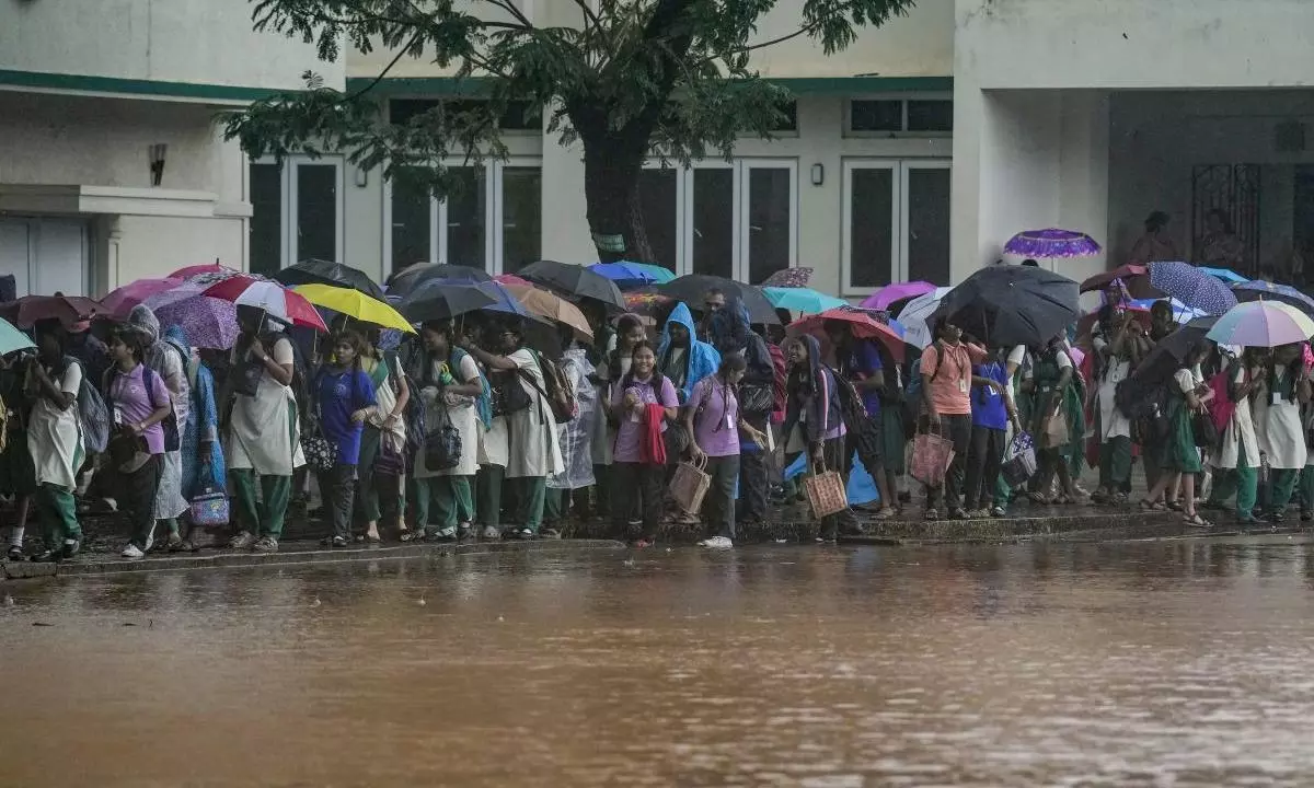
The remnants of Cyclone Ditwah brought heavy rain to the northern Tamil Nadu districts, including Chennai. The daily lives of residents were severely disrupted after consecutive days of rainfall in the city.
Reports say many localities in North Chennai, including Perambur and Vyasarpadi—areas that are flood-prone due to negligence and lack of planned infrastructure—were inundated, leaving people confined to their homes. Residents of Purasawakkam and Pulianthope also faced waterlogging due to the incessant rain.
Also Read:Cyclone Ditwah weakens into deep depression; all stranded Indians airlifted from Lanka
The Greater Chennai Corporation (GCC) swiftly took action to clear water stagnation and arranged food and other relief materials for the affected people in the city.
Meanwhile, the rain reportedly submerged 90,000 hectares of farmland across the delta districts.
Many parts of the city have been inundated due to heavy rain. Photo: PTI
Stalled Ditwah
Rain pounded Chennai and neighbouring Kancheepuram, Tiruvallur, and Chengalpattu districts (the KTC belt) as Cyclone Ditwah weakened into a deep depression and further into a well-marked low-pressure area.
According to reports, Cyclone Ditwah was expected to move towards the north or east. However, a rare microphysical change in the system caused it to stall near coastal Tamil Nadu and then recurve towards the southwest.
Also Read: Sri Lanka closes offices, schools as death toll from landslides and floods rises to 56
The slowed-down system brought more rain to Chennai and the KTC belt, triggering sudden inundation in residential areas and on arterial roads. Villupuram, Cuddalore, and Tiruvannamalai also experienced frequent heavy spells with brief intervals as the depression moved inland.
Wednesday was recorded as the third consecutive wet day this week. Several parts of the state have been witnessing rainfall activity since last week, disrupting the livelihoods of small traders and hindering residents’ free movement.
Low pressure
“The depression (remnant of cyclonic storm Ditwah) over the southwest Bay of Bengal and adjoining north Tamil Nadu–Puducherry coasts moved slowly southwestwards and weakened into a well-marked low-pressure area over the north Tamil Nadu–Puducherry coasts and its neighbourhood,” the IMD said.
Also Read: RTI reveals snail-paced modernisation of critical safety systems in Southern Railway
It was likely to continue moving slowly southwestwards across the north coastal Tamil Nadu and Puducherry region and weaken further into a low-pressure area over the next 24 hours, the weather office added in its bulletin.
Suspension of fishing
The RMC suspended fishing operations over the southwest and adjoining west-central Bay of Bengal and along and off the Tamil Nadu, Puducherry, and south coastal Andhra Pradesh coasts until Wednesday afternoon.
Also Read: Chennai Metro train stalls in tunnel; 20 passengers rescued
It also forecast wind speeds reaching 35–45 kmph, gusting to 55 kmph, which were expected to gradually decrease from Wednesday morning. The sea conditions were predicted to improve from rough to moderate from Wednesday morning.
(With agency inputs)

