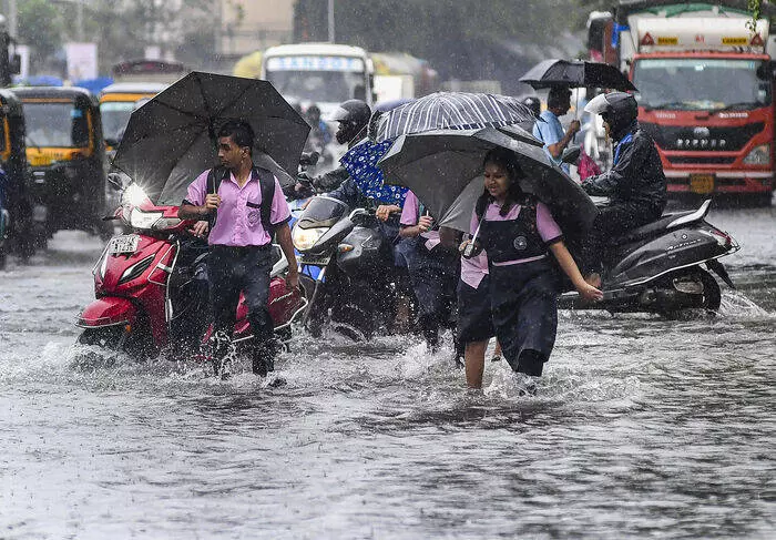
Commuters wade through waterlogged roads in Mumbai. Photo: PTI
Heavy rain lashes Mumbai amid 'red alert' warning
Many areas of south Mumbai recorded over 100 mm of rainfall in the last 24 hours; IMD predicts more 'heavy to very heavy' rain

India’s financial capital, Mumbai, was battered by heavy overnight rains on Saturday (September 27) amid a ‘red alert’ warning. The intensity eased on Sunday (September 28) morning, but authorities were prepared for all eventualities as the prediction for heavy rain remained high.
The India Meteorological Department (IMD) said parts of south Mumbai received more than 100 millimetres (mm) of precipitation in the last 24 hours.
IMD issues red alert
The rain affected train timings as local services of the Central Railway and Western Railway were running behind schedule. Buses of the Brihanmumbai Electric Supply and Transport (BEST) undertaking were operating without any diversion.
Also read: Hyderabad floods: Old City, IT hubs inundated as Musi River overflows
The IMD on Saturday issued a ‘red alert’, predicting “heavy to very heavy” rainfall in Mumbai on Sunday.
A civic official, quoting the IMD’s forecast issued at 8 am on Sunday, said the city will witness “cloudy sky with heavy to very heavy rainfall accompanied with thunderstorm/lightning and gusty winds reaching 40-50 kmph very likely in the city and suburbs”.
There was a “possibility of extremely heavy rain at isolated places,” according to the weather department.
In a post on X on Sunday morning, the weather department said, “Depression over east Vidarbha and nbd moved westwards with a speed of 43 kmph during past 6 hours and lay centred at 0530/28 Sept, over west Vidarbha and nbd, 50 km south of Akola (Vidarbha). It is very likely to move nearly westwards across Marathwada & adj Madhya Maharashtra.”
Depression over east Vidarbha and nbd moved westwards with a speed of 43 kmph during past 6 hours and lay centred at 0530/28 Sept, over west Vidarbha and nbd, 50 km south of Akola (Vidarbha). It is very likely to move nearly westwards across Marathwada & adj Madhya Maharashtra. pic.twitter.com/vIjhQYGufF
— India Meteorological Department (@Indiametdept) September 28, 2025
In a subsequent post, it said it would weaken gradually into a well-marked low-pressure area over the next 12 hours. As the intensity reduced by the early hours of Sunday, most parts of Mumbai have received light to moderate rain, with intermittent intense spells.
Also read: Telangana rains: IMD issues orange alert; CM asks officials to stay alert
In the 24 hours ending at 8.30 am on Sunday, the Colaba observatory (representative of the island city) recorded 120.8 mm of rainfall, while the Santacruz observatory (representing the suburbs) registered 83.8 mm of rains.
Among the prominent areas, Juhu reported 88 mm rainfall, Bandra 82.5 mm and Mahalaxmi 28 mm during the period, as per the IMD.
There will be a high tide of 3.24 metres at 2.55 pm and a low tide of 1.31 metres at 8.50 pm on Sunday, an official said.
Heavy rain coupled with high tide leads to waterlogging in low-lying areas, while low tide helps in speedy water receding.
The weather department also issued a ‘red alert’ for neighbouring Raigad, Thane and Palghar districts on Sunday.
Authorities prepare for emergency
In view of the IMD’s prediction, the Maharashtra State Emergency Operation Centre asked officials to be on high alert. The government also cautioned the public about urban flooding in low-lying zones of Mumbai and Konkan districts, landslides in ghat areas and the danger of flash floods.
Also read: What caused Kolkata floods? A near-cloudburst, outdated drainage, ecological apathy
Round-the-clock control rooms were also initiated, and authorities were keeping a close watch on the flow of river water and the levels of dam discharge. Repair teams and disaster-management equipment were also kept ready.
(With Agency inputs)

