




- Home
- India
- World
- Premium
- THE FEDERAL SPECIAL
- States
- Perspective
- Videos
- Sports
- Education
- Entertainment
- Elections
- Features
- Health
- Business
- Series
- In memoriam: Sheikh Mujibur Rahman
- Bishnoi's Men
- NEET TANGLE
- Economy Series
- Earth Day
- Kashmir’s Frozen Turbulence
- India@75
- The legend of Ramjanmabhoomi
- Liberalisation@30
- How to tame a dragon
- Celebrating biodiversity
- Farm Matters
- 50 days of solitude
- Bringing Migrants Home
- Budget 2020
- Jharkhand Votes
- The Federal Investigates
- The Federal Impact
- Vanishing Sand
- Gandhi @ 150
- Andhra Today
- Field report
- Operation Gulmarg
- Pandemic @1 Mn in India
- The Federal Year-End
- The Zero Year
- Science
- Brand studio
- Newsletter

Why despite Earth observation satellite images, there was little on-time alert of Nepal-Tibet floods
When the NASA-ISRO Synthetic Aperture Radar satellite (NISAR), was launched in 2025, it was described as an eagle eye in the sky. But last month's Nepal-Tibet floods happened with savage suddenness. Only after the event did scientists begin analysing previously taken satellite images from the region and found signs of ground deformation and acceleration on the slope. The picture was there, but no one was reading it in real time and no warning reached the valleys below.

The NASA-ISRO Synthetic Aperture Radar satellite (NISAR), which was launched in July 2025 at a cost of over a billion dollars, was described as an eagle eye in the sky. It was expected to revolutionise our alert mechanism for natural disasters.With its dual-frequency radar, it can see through clouds, measure ground movement down to the millimetre, track glaciers, detect landslides, and...
The NASA-ISRO Synthetic Aperture Radar satellite (NISAR), which was launched in July 2025 at a cost of over a billion dollars, was described as an eagle eye in the sky. It was expected to revolutionise our alert mechanism for natural disasters.
With its dual-frequency radar, it can see through clouds, measure ground movement down to the millimetre, track glaciers, detect landslides, and map changes across the Earth's surface every few days. Indian and American officials discussed its potential to revolutionise disaster management, particularly in the fragile terrain of the Himalayas. Coming soon after the Wayanad landslide disaster (2024), people felt a sense of relief — after all, here was a tool that could provide early warning of the hazards that continue to cost lives in our mountains.
Yet, when the catastrophic ice-rock avalanche and flash floods rushed through the Nepal-Tibet border area on August 26, killing more than a thousand people and leaving thousands missing, the NISAR satellite, together with the other dozens of Earth observation satellites in orbit, provided us with very little information in time.
The disaster happened with savage suddenness. Only after the event did scientists begin analysing previously taken images from the region and found signs of ground deformation and acceleration on the slope that eventually failed. The picture was there, but no one was reading it in real time, no automated system detected the anomaly with immediacy and no warning reached the valleys below.
This is not surprising. Sudden slope failures in high mountain areas that develop into rubble flows are notoriously hard to predict accurately. The time available beforehand is usually only minutes, or at most a few hours. Even with perfect satellite data, it is not possible to ensure there are no false alarms or to determine the exact time of the event. Satellites have repeatedly proved useful afterwards: they have been used to map the extent of the damage, to assist in relief operations and to help reconstruct the sequence of events. Yet in terms of preventing the human tragedy itself, they have done very little.
Also read: Why Nepal-Tibet floods have brought back memories of an 'unforgiving' Kailash trek for this Indian
At present, hundreds of Earth observation satellites are in operation; the number is estimated to be between about 800 and over 1,500 when optical, radar, weather, and similar types of satellites are included. India has about 21 civilian Earth observation satellites in its active satellite fleet. Moreover, globally, there are somewhere between 700 and 1,200 dedicated military reconnaissance and Intelligence, Surveillance, and Reconnaissance (ISR) satellites (often referred to as ‘spy satellites’) that continuously monitor Earth's surface for national security reasons.
The NASA-ISRO Synthetic Aperture Radar satellite. File photo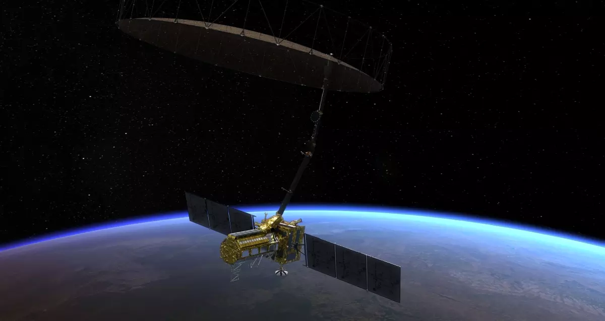
Having images does not mean they are being used, however. You cannot play music just by having a pendrive; you need a working player, speakers and someone who knows how to use the system. Similarly, raw satellite data must be processed, compared with ground truth, and analysed for subtle changes. They must then fuse it with other sensor inputs and turn it into actionable warnings that reach communities and local authorities. This requires continuous investment in ground stations, computing pipelines, trained analysts, formal institutional authority, and last-mile communication. Without this ecosystem, the "eyes in the sky" stay mostly decorative for disaster preparedness.
Yet the same satellites, when funded well, work in real time. The same technology — synthetic aperture radar, high-resolution optical sensors, machine learning on geospatial data, multi-source fusion — works remarkably well for military reconnaissance. No nation pulls its punches when it comes to national security. Human, financial and material resources pour into lessening latency, maintaining large teams of analysts, and building systems that can extract the emerging picture under time pressure. Military ISR benefits fully from the eyes in the sky because societies treat it as existential.
Disaster preparedness, by contrast, is still too often treated as an “act of God”— something regrettable but not worthy of the same continuous, high-priority investment. The underlying science is largely the same. What differs dramatically is the priority, resources, institutional design and operational seriousness attached to the use case. Technically identical, but disaster preparedness and military ISR are institutionally worlds apart.
India’s academic institutions are developing the capability to move Earth-observation satellites from disaster mapping towards early-warning systems, increasingly by combining satellite observations with weather models, physical simulations and artificial intelligence. Satellites provide continuous observations, weather models anticipate triggering conditions, physical models simulate what may happen and AI can rapidly combine these datasets for identifying where disaster risk is likely to emerge.
For landslides, Indian Institute of Technology (IIT) Roorkee is developing satellite-interferometry-based systems to detect ground movement and combining rainfall thresholds, sensors and machine-learning methods to identify slopes at risk. In collaboration with Indian Institute of Science Education and Research (IISER) Mohali and Indian Space Research Organisation’s (ISRO’s) National Remote Sensing Centre (NRSC), researchers are also working on rainfall-triggered landslide and debris-flow warning systems for the Himalayas. These approaches combine satellite rainfall, terrain characteristics and historical landslide data to locate areas approaching dangerous conditions.
NISAR was launched in July 2025. File photo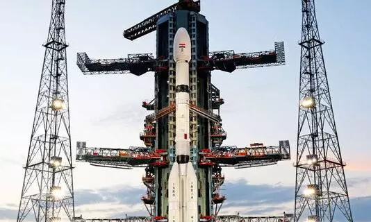
For floods, IIT Delhi is combining hydrological and fluid-dynamic models, satellite observations, rainfall forecasts, and AI. Its BrahmaSATARK project is developing real-time, impact-based flood forecasts for the Brahmaputra basin, while other research explores deep-learning approaches for producing street-scale flood forecasts.
At IIT Bombay, researchers are developing AI systems that combine optical and radar satellite imagery with maps, street networks and exposure data for flood monitoring, multi-hazard analysis and disaster decision-making. Research elsewhere covers glacial lake outburst floods (GLOFs) and glacier hazards, drought and vegetation stress, forest-fire risk, cyclone and storm-surge inundation, river erosion and sediment movement, and urban flooding.
Taken together, these efforts show that Indian institutions have the scientific building blocks for satellite- and AI-enabled early-warning systems; what we lack is scale and political will.
The scientific knowledge and technical means needed for improved disaster prediction are within our reach, since we already have the necessary sensors, algorithms and computing power. What is missing is a political and economic system that treats ordinary people's lives as deserving of the same level of continuous investment as military objectives. Both markets and governments direct their resources toward applications expected to yield profit or provide tactical advantages; protecting remote mountain communities from rare cascading hazards is rarely profitable in the short term. As long as this kind of calculation does not change, the technological possibility will stay underused.
This is not a new insight. Nearly a century ago, the British scientist and thinker JD Bernal argued in the book The Social Function of Science that science is never neutral or given; society that funds and directs it shapes it. Science can serve private profit and military power, or it can be consciously organised to meet human needs. Bernal insisted that ordinary people, through collective pressure and democratic choice, can force science and technology to work for the common good rather than for narrow interests. The tools exist. The question is whether we organise ourselves to demand that we use them differently.
There are already efforts in this direction. The United Nations’ Early Warnings for All (EW4All) initiative, launched in 2022 and co-led by the World Meteorological Organisation and the UN Office for Disaster Risk Reduction, aims to make certain that every person on Earth is protected by multi-hazard early warning systems by 2027. UN bodies are keenly exploring how artificial intelligence, satellite data, and ground networks can be combined to close the gaps that leave so many communities exposed. These projects show that another approach is possible, if political will and public pressure catch up with the technology.
EW4All has generated genuine momentum and measurable progress. It is no longer only a slogan. However, major powers’ seriousness remains partial: rhetorical support and project-based funding exist, but the scale, consistency, and longstanding functional commitment still lag behind the stated ambition and far behind the resources routinely mobilised for military intelligence, surveillance and reconnaissance systems. Without stronger, sustained political will and financing that treats early warning as essential public infrastructure rather than optional aid, the 2027 universal-coverage goal will remain out of reach for millions of the most vulnerable people.
Also read: How the Nancy Grace Roman Space Telescope, NASA’s latest eye in space, will help decode the universe
An even more distressing and repulsive trend persists. Even when agencies such as ISRO produce clear data — as in the case of ground subsidence in Joshimath (2023) — or when US scientific bodies issue repeated warnings about climate risks and glacial instability, ruling dispensations sometimes prefer to hush it up. These facts do not match their rhetoric. Uncomfortable truths are inconvenient for short-term political spins. Science that questions development models or exposes vulnerabilities is quietly sidelined; at times, chillingly silenced.
So if one asks why NISAR failed to give timely warning of the Nepal disaster, the question should not be directed primarily at NISAR, Earth observation satellites, or ISRO. The real question is what priorities we, as a society, choose. We have built powerful eyes in the sky. We have not yet built the corresponding will, institutions, and systems on the ground to use those eyes to protect ordinary lives with the same seriousness we show when the target is military. Natural disasters, too, are enemies of the people, yet we continue to pay them far less attention. Until that changes, the next Himalayan tragedy will again find us looking at the data only after the waters have receded and lives have been lost.